
Watch a chunk of NC’s coast vanish after power outage that forced evacuation of island
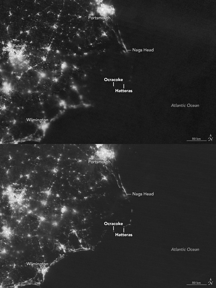
A compilation of nighttime images from NASA shows part of North Carolina’s coast disappearing in a matter of seconds, potently showing how residents in the Outer Banks have been living without power for almost a week.
NASA took satellite images of North Carolina’s coast on the early morning of July 27, before a large blackout began, and on July 30.
Crews of the Cape Hatteras Electric Cooperative, the company building the new Bonner Bridge, damaged three power cables about 4:30 a.m. on July 27, causing the mass blackout. Hyde County officials evacuated visitors from Ocracoke Island and issued a state of emergency that afternoon.
Utilities officials say full power may be restored as early as Aug. 5.
The images are below.
This story was originally published August 2, 2017 at 11:31 AM.