
Could snow be coming to the Midlands? Or ice? Here’s the latest from the Weather Service.
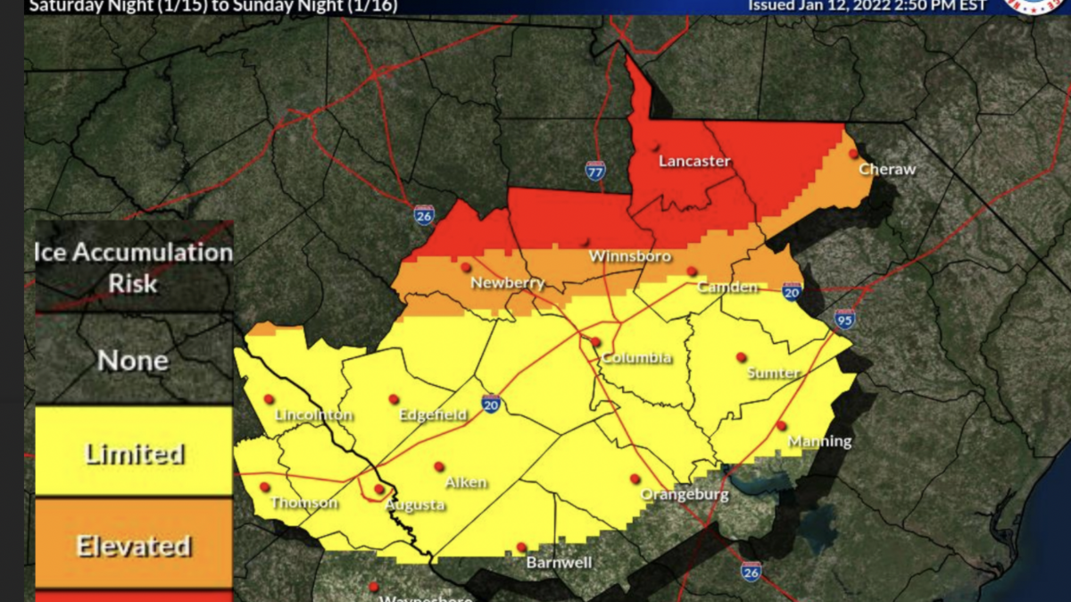
Maybe ice, for sure rain. It’s still too early to say for sure.
That’s the report from the National Weather Service early Thursday morning about the winter storm expected overnight Saturday into Sunday.
“Significant icing possible with greatest threat in the north Midlands.” the Weather Service said. “This may lead to accumulating ice causing hazardous travel and power outages.”
The area around Lancaster and the extreme northern part of South Carolina could see ice; the greater Columbia area is expected to see rain.
“The amount of icing is still uncertain, but accumulating ice is expected in the northern Midlands,” the Weather Service said.
Temperatures are expected to be in the 40s during the day and 20s at night, lasting into next week.
The last snowfall in the Midlands was Jan. 6, 2017, when about a tenth of an inch was recorded, according to data from the National Weather Service.
The storm, named winter storm Izzy by the Weather Channel, is coming from the upper Midwest and then tracking into the South and up into the Northeast by Sunday morning, where temperatures are expected to be in the low teens.
The SC Department of Transportation, meanwhile, has begun its winter storm operations plan in case of a “worst-case scenario.”
Priority roads and bridges will be pre-treated with anti-icing agents beginning Thursday in areas where winter weather is predicted.
“These priority routes consist of all interstates and routes that are essential to the movement of traffic, many of which service emergency facilities.,” SCDOT said in a news release.
The agency said it has 60,000 tons of salt, over 525,000 gallons of salt brine and approximately 275,000 gallons of ice breaking chemicals at the ready.
This story was originally published January 13, 2022 at 8:13 AM.