
Work on greenway connecting Lake Murray to Columbia to begin soon. When might it open?
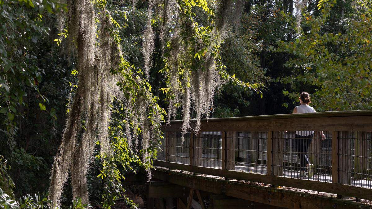
An in-progress greenway trail running the length of the Lower Saluda River is getting closer to becoming a reality.
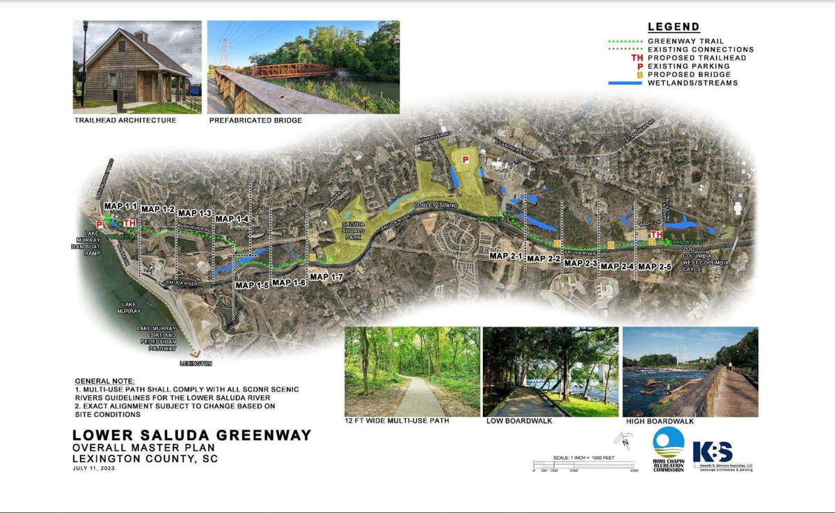
Once the proper permits are in place, construction can begin on a new section of the Lower Saluda Greenway that will run from the Lake Murray Dam to Saluda Shoals Park, meaning it could be completed and open to the public next year, Mark Smyers, the executive director of the Irmo-Chapin Recreation Commission, said in a public presentation last week.
In the second phase of the planned project, the trail will continue from Saluda Shoals’ lower boat ramp through a Shaw Industries property until it hits the canoe put-in at the Gardendale boat ramp, Smyers said. A third phase connecting to the existing stretch of the Saluda Riverwalk that runs past Riverbanks Zoo is planned, he said, but it depends on completion of the Carolina Crossroads project at the intersection of Interstate 20 and Interstate 26, which isn’t expected until 2029.
By then, Smyers added, the River Alliance, the nonprofit that has long advocated for river access and the vision of a unified Three Rivers Greenway connecting the lake to Columbia, West Columbia and Cayce, should be done with its proposed pedestrian bridge across the Congaree River. The bridge will connect the other end of the Lower Saluda Greenway to the trail running along the Columbia Canal.
The idea of this unified path along Columbia’s rivers has been getting closer and closer to fruition the last few years.
Officials announced as far back as 2023 that Dominion Energy had leased 200 acres upstream from Riverbanks Zoo for future hiking trails and mountain bike paths, making the completion of a single greenway stretching from the dam all the way to the juncture of the Saluda and Broad rivers that much more feasible.
Much of the new greenway, Smyers said, is slated to run along the Dominion easement on trails that will be as wide as 12 feet in some areas.
“This stems all the way back to the late ‘80s and early ‘90s,” when plans for Saluda Shoals first got off the ground, Smyers told a meeting of the Lexington-Richland 5 school board. “The project I’m going to unpack for you is a 40-year dream.”
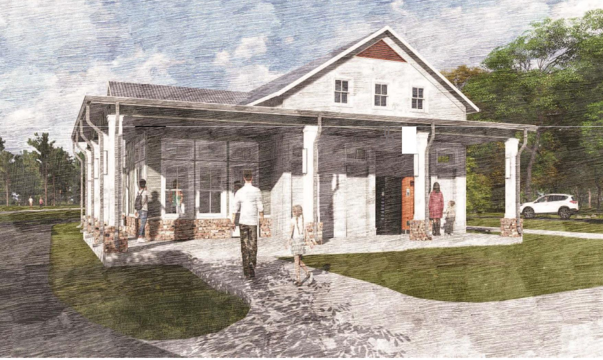
The trail will start near the dam at the intersection of Bush River Road and North Lake Drive, where an existing sidewalk will be extended down into what is currently a wooded area, which will become the site for a parking lot and a small public building to mark the beginning of the trailhead.
“This will include restrooms, a gate office ... but we’re trying to be as light on the land as we can,” Smyers said.
From there, the trail continues through a wooded area just north of the Saluda River, threading between a Lexington County waste collection site and an easement for Dominion’s energy transmission lines. At one point, the path will cross directly behind the gate for the McMeekin power station. Plans call for boardwalks for passing over wetland areas before the trail reaches Sandy Island near Saluda Shoals Park.
Once completed, the trail will link with the Three Rivers Greenway connecting riverwalks along both sides of the Congaree, stretching “27 miles from the lake to the Cayce tennis center,” Smyers said. Eight miles of the trail will run through Lexington-Richland 5, he told the school board.
The recreation commission has secured funding for the $24 million project from local, state and federal dollars — including a $3.2 million federal grant from the U.S. Department of Commerce — and is currently seeking the permits to complete the trail from the Federal Energy Regulatory Commission, which regulates Lake Murray and its waterways.
”We have a contractor under contract today to begin once we get our full clearance from them,” the recreation director said. The contract period runs for 15 months, “so if that begins soon we’re looking at somewhere around middle of next year” for completion of the first phase of the greenway, he said.
This story was originally published February 19, 2025 at 5:00 AM.
.jpg)