Tornado watch issued for the Midlands as severe weather approaches
A tornado watch was issued for the Midlands hours after the National Weather Service said there’s a risk for severe weather Monday.
The tornado watch is in effect until 7 p.m. for the Columbia area, as well as parts of Georgia and North Carolina, according to the National Weather Service.
A couple of tornadoes could possibly form as scattered thunderstorms move through the region in the afternoon, according to a hazardous weather outlook.
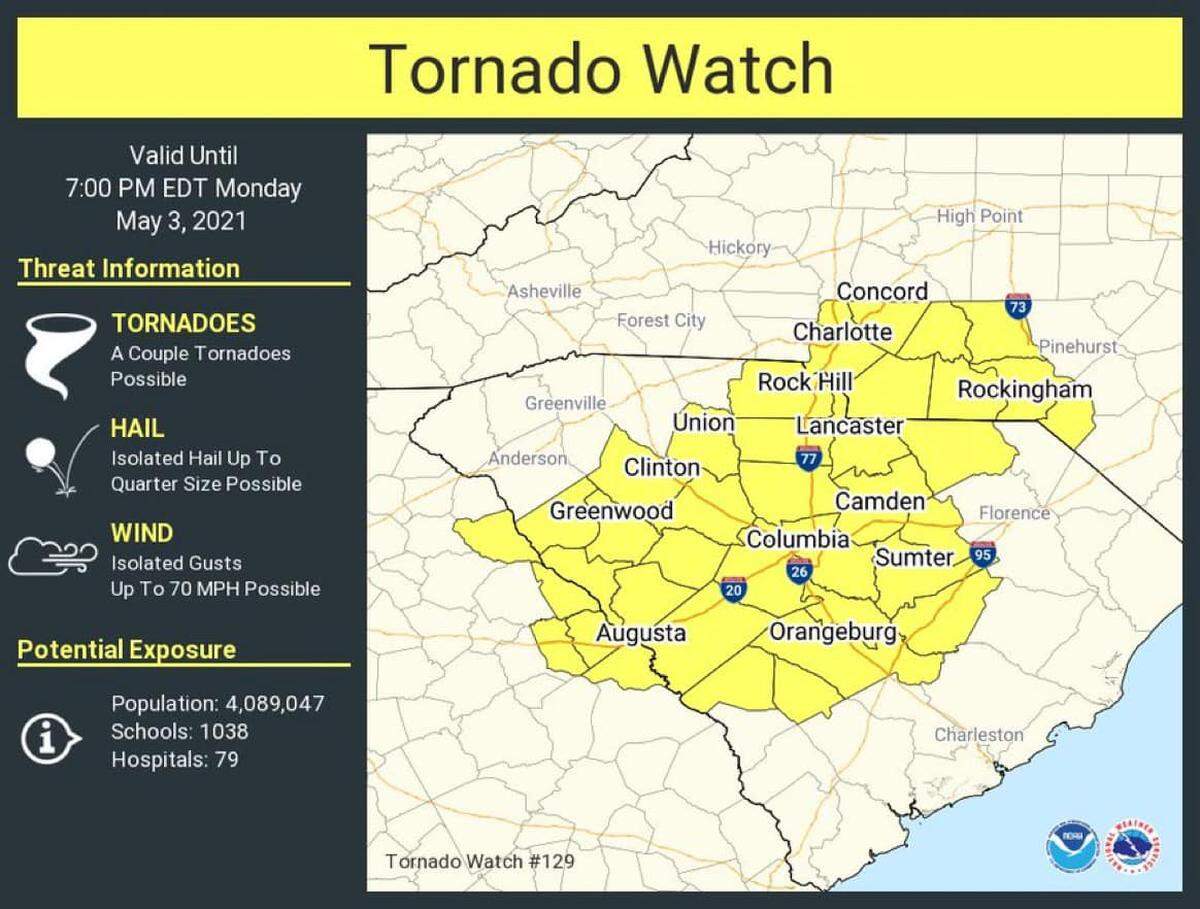
In addition to tornadoes, damaging winds, hail, and lightning are the main threats posed by the storms, according to the National Weather Service.
At about 1:30 p.m., forecasters said showers and storms will begin to move into the Midlands within next two hours.
The thunderstorms are expected to move east of the Midlands, or diminish, by 10 p.m., the National Weather Service said in a morning briefing.
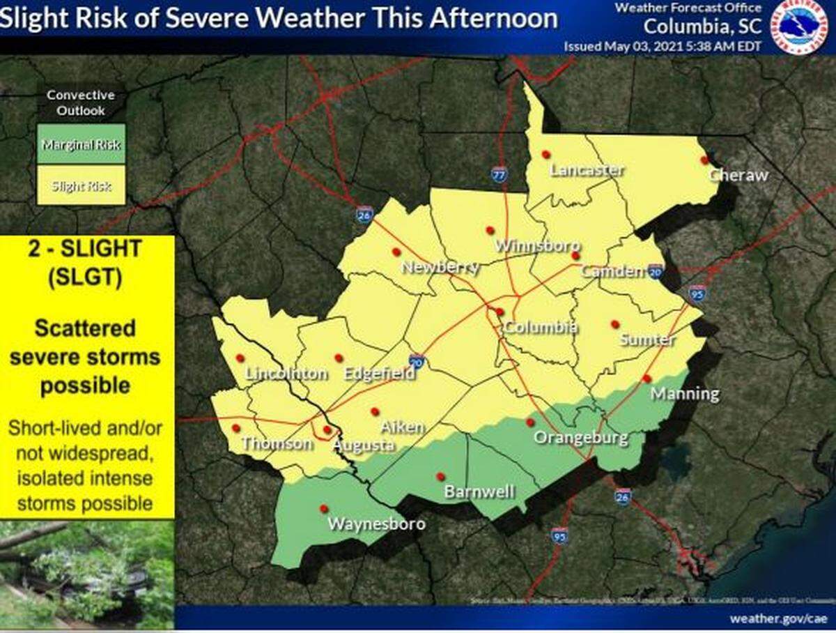
The possibility of severe weather has risen to a slight risk for the area that includes Richland, Lexington, and Kershaw counties along with much of the rest of the Midlands, according to the hazardous weather outlook.
A tornado warning was issued for Abbeville, Due West, and Cokesbury until 3 p.m., according to the National Weather Service.
At about 2:20 p.m., a tornado was confirmed near Lowndesville in Abbeville County, the National Weather Service said.
Damaging winds could cause considerable damage to trees and branches, which creates the possibility of downed power lines and outages. Wind gusts could be as powerful as 70 mph, according to the National Weather Service.
The hail, which could be as large as quarters, can damage vehicles and roofs, according to the National Weather Service.
Occasional to frequent lightning hazards could also be a threat, according to the forecast.
While the storms are predicted to be short-lived and isolated, they could be intense, the briefing said.
More than a quarter of an inch of rain could fall in Columbia by the end of Monday night, as there is a 100% chance of precipitation, according to the forecast. Higher amounts of rainfall are possible in certain areas affected by thunderstorms.
Temperatures are expected to approach a high in the mid 80s, before dropping to a possible low of 68 degrees at night, according to the forecast. Warm temperatures, in the mid-to-high 80s, and more rain is predicted in the Columbia area on Tuesday and Wednesday.
Strong to severe thunderstorms are possible again on Tuesday and Wednesday, according to the hazardous weather outlook.
No further showers are expected at the end of the week, the forecast shows.
This is a developing story, check back for updates.
BEHIND THE STORY
MOREThis is a breaking news story
In a breaking news situation, facts can be unclear and the situation may still be developing. The State is trying to get important information to the public as quickly and accurately as possible. This story will be updated as more information becomes available, and some information in this story may change as the facts become clearer. Refresh this page later for more updated information.
This story was originally published May 3, 2021 at 10:18 AM.