
Will storms dampen fireworks in the Midlands? Here’s the rain forecast for July 4 weekend
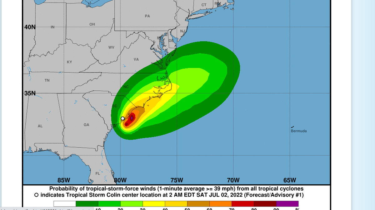
While rain might threaten Independence Day celebrations in the Midlands, Tropical Storm Colin won’t be to blame.
The tropical storm, which formed overnight Friday into Saturday 40 miles southwest of Myrtle Beach and was expected to reach a sustained windspeed of 40 miles per hour, is already moving up the coast towards Wilmington, North Carolina.
But that doesn’t mean Midlands residents should expect a dry Independence Day. Thunderstorms and scattered showers are still forecasted for Sunday and Monday evenings, with the chance of rain at about 50%, according to the National Weather Service.
“It’s your typical summertime showers and thunderstorms,” said Chris Rohrbach, a forecaster with the National Weather Service in Columbia.
Some of the biggest fireworks displays in the Midlands are planned for Saturday night, when the skies are expected to be mostly clear. Among other events, Segra Park in downtown Columbia will host Fireworks with the Phil, Fort Jackson will put on a fireworks show, and the skies over Lake Murray will light up, as well. On Monday, Independence Day, you can catch fireworks at Segra Park after the Columbia Fireflies ballgame, and the Lexington County Peach Festival will conclude with fireworks behind Gilbert Primary School.
Fireworks are still expected to go ahead, but residents might want to prepare for unpredictable weather. While some storms are expected linger into evening, Rohrbach says that it’s hard to predict at this point where those are going to be.
While the weather along the coast is expected to clear up as Colin moves north, tropical storm warnings are still in effect along parts much of the coast. The National Weather Service’s hazardous weather outlook is still in place for much of the Lowcountry.
Those driving Saturday and Sunday should still be prepared for heavy rainfall and be alert to localized flash flooding.
This story was originally published July 2, 2022 at 2:59 PM.