Wind advisory issued in the Midlands. Here’s when severe weather is forecast to hit
A wind advisory has been issued for the Columbia area, as powerful storms are forecast to hit the Midlands region of South Carolina.
The wind advisory goes into effect at 6 a.m. Tuesday and will run through 9 p.m., according to the National Weather Service.
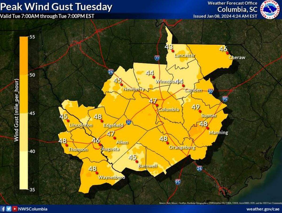
Strong winds are predicted, with powerful gusts that could reach 45 mph, the National Weather Service said in a Monday morning briefing.
Additionally severe thunderstorms and tornadoes are potential threats across the Midlands on Tuesday, according to the briefing.
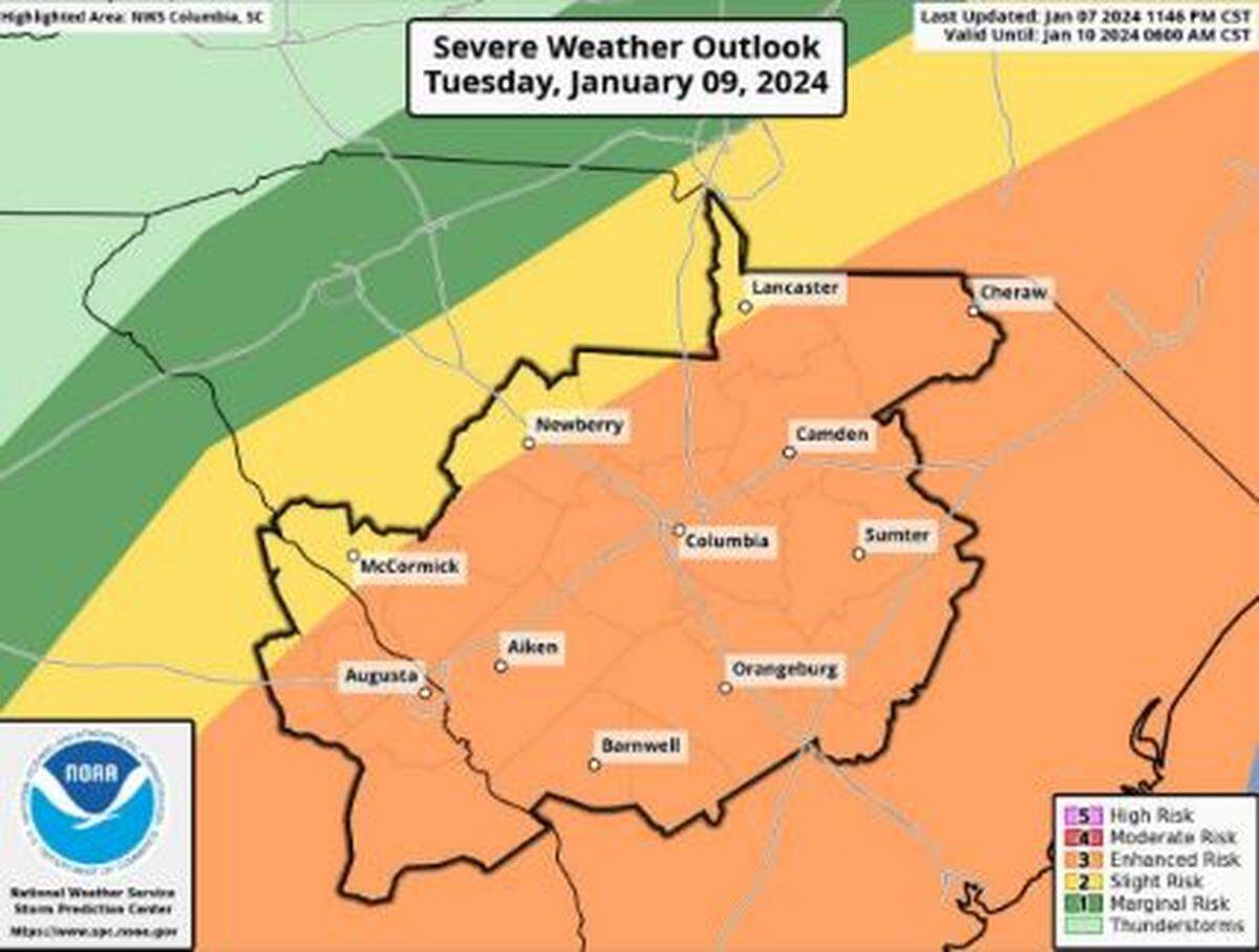
Rain is expected to move into the Columbia area early Tuesday morning, and then winds are expected to increase, the National Weather Service said. The gusts are forecast to increase in strength by midday and remain a threat into the evening, according to the briefing.
Even after the line of showers and storms move through the area, winds will remain strong and gusty through Tuesday night and into Wednesday, when they could reach 30 mph, the National Weather Service said.
Powerful winds and tornadoes could cause considerable damage to trees and branches, in addition to mobile homes, roofs and outbuildings. Vehicles would also be under siege in the case of a tornado.
Damage to trees and branches creates the possibility of downed power lines and outages.
“Now is the time to secure outdoor items and prepare for the possibility of power outages,” the National Weather Service said on social media.
Meteorologists also urged drivers to use caution on Tuesday because winds this strong can make driving difficult.
“If you must drive during the worst of the weather, adjust your speed and follow distance accordingly,” the South Carolina Department of Public Safety said on social media.
There is a 100% chance of precipitation in the Columbia area, and up to 2 inches of rain is possible Tuesday, the forecast shows. Localized amounts in other areas of the Midlands could be higher.
There is a low potential for flash flooding, but river flooding is possible in the days following the storms and into next week, according to the briefing.
The warmest temperatures of the week are expected to accompany the storms, with a high of 68 degrees possible in Columbia on Tuesday. Things will cool off the days following the storms before warming again around the weekend when more rain is forecast for the Midlands.
BEHIND THE STORY
MOREThis is a breaking news story
In a breaking news situation, facts can be unclear and the situation may still be developing. The State is trying to get important information to the public as quickly and accurately as possible. This story will be updated as more information becomes available, and some information in this story may change as the facts become clearer. Refresh this page later for more updated information.
This story was originally published January 8, 2024 at 9:43 AM.