Tornado warning issued in Midlands counties, weather service says
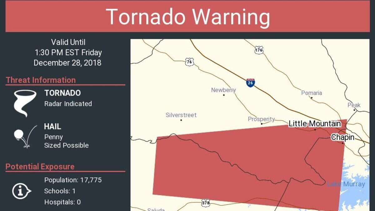
Lexington County and surrounding areas were placed under a tornado warning Friday afternoon, according to an alert from the National Weather Service.
The tornado warning took effect at about 1 p.m., covering Newberry, Saluda and Lexington counties, according to the alert.
Chapin was included at the edge of the warning, which will last until about 1:30 p.m., according to a map from the NWS.
Those included in the tornado warning could possibly see penny-sized hail.
The National Weather Service said they won’t have any information on damage or whether or not a tornado formed until later Friday afternoon, an official said at about 1:45 p.m.
The chance for rain is in the forecast through the end of next week, according to the Weather Service.
Officially Friday, the forecast is for “a chance of showers and thunderstorms, then showers and possibly a thunderstorm after 3 pm. High near 74. Southwest wind 10 to 13 mph, with gusts as high as 23 mph. Chance of precipitation is 90 percent.”
Friday night’s low is forecast to be 60.
This story was originally published December 28, 2018 at 1:12 PM.