
When will Hurricane Erin impact SC? Here’s the timetable and forecast
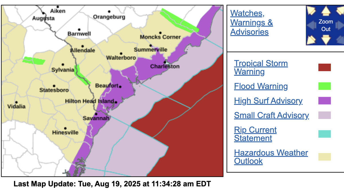
South Carolina is already feeling the effects of Hurricane Erin, which has at times been categorized as a 5, 4, and now a 2 level storm.
The National Weather Service in Charleston reported Monday night that swell waves were impacting area beaches.
“Today, we had ~12 reported rip currents along GA & SC beaches, with 1 rescue at Hilton Head Island, SC. Life-threatening surf & rip current conditions expected tomorrow, remaining through the rest of this week,” the weather service said on Facebook.
National Hurricane Center maps show the greatest impacts on South Carolina will come Wednesday morning.
Inland areas of South Carolina are not likely to be affected by the storm, which Tuesday morning was about 665 miles southwest of Bermuda and about 720 miles south-southeast of Cape Hatteras, North Carolina.
The National Hurricane Center said the storm will turn toward the north-northwest with an increase in forward speed Tuesday, followed by a northward motion on Wednesday and then a northeastward motion on Thursday.
“On the forecast track, the center of Erin will pass to the east of the Bahamas today and tonight, and then move over the western Atlantic between the U.S. east coast and Bermuda on Wednesday and Thursday,” the center said in its Tuesday morning bulletin.
The National Hurricane Center initially predicted moderate effects on the South Carolina coast but has since said to prepare for dangerous conditions.
The Outer Banks in North Carolina is likely the area most in jeopardy in the South and from flooding and evacuation orders have been made. Tropical storm warnings are in effect there.
Waves of 10 to 20 feet could be seen over the next several days and rip currents, narrow channels of fast-moving water can pull people away from shore, will be dangerous, forecasters said.
Rainfall on the Outer Banks Wednesday night into Thursday could be 1 to 2 inches and possibly 4 inches in places.
Erin was a Category 5 hurricane in the Caribbean Saturday and was downgraded to a Category 2 storm Tuesday morning. Category 2 hurricanes have maximum sustained winds from 96 mph to 110 mph.
This story was originally published August 19, 2025 at 12:09 PM.