
Tropical storm may develop and reach SC soon. Here’s what weather the Midlands can expect
Hurricane season is in full swing and while it’s been relatively quiet so far, the tropics are starting to become more active.
Earlier this month, there was a change in this season’s hurricane forecasts due to the increasing presence of El Niño, slightly reducing the number of expected named storms to develop. The U.S. is still expected to be hit with the same number of storms, however.
One named storm, Tropical Storm Arthur, hit the U.S. last month, causing flash flooding and tornadoes in parts of the South.
Now, weather forecasters from AccuWeather and the National Weather Service are saying there is a chance of another tropical storm developing along the coast late this weekend and early next week. Predictions are early and easily changeable, but the tropical threat could reach South Carolina.
“So far, we believe the chance of a tropical depression or storm forming in this area is low, but probably represents the best chance for tropical development throughout the Atlantic basin prior to the end of July,” AccuWeather Lead Hurricane Expert Alex DaSilva said in a forecast.
Here’s how it may impact South Carolina and the Midlands if it does develop:
Chance of tropical storm reaching SC
According to an early forecast from NWS, there’s less than a 40% chance of a tropical cyclone forming near the Gulf Coast, possibly impacting Florida, Georgia and the Carolinas. Their meteorologists are predicting limited potential impacts on land if it were to develop.
AccuWeather’s latest forecast says there’s a medium tropical storm development risk on the South’s coast, primarily affecting Florida, but with the chance of tropical rain and wind impacting South Carolina between July 18 and July 21.
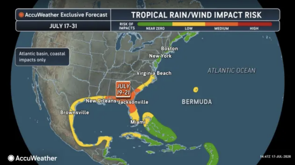
“Wind shear is expected to weaken across the northeastern Gulf this weekend into early next week,” DaSilva said. “This, combined with exceptionally warm sea surface temperatures in the middle to upper 80s F, or 2-4 degrees above the historical average, can create favorable conditions for tropical development.”
How will this affect weather in the Midlands?
Currently, meteorologists are expecting thunderstorms, strong winds and possible flash-flooding this weekend across the Southeast, even if a tropical storm doesn’t develop.
“Heavy rainfall is likely to be the biggest impact from any storm that evolves,” DaSilva said.
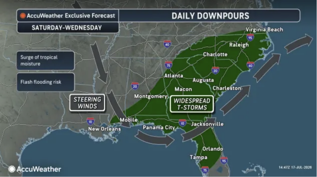
If heavy rain does make its way to the Midlands, it could trigger flash-flooding, but it would also provide some much-needed drought relief.
The NWS released a weekend weather advisory for the Midlands as isolated scattered thunderstorms are expected to develop, with the possibility of strong to marginally severe storms. The strongest storms this weekend will, at most, cause damaging wind gusts.
Even with cloud coverage, it’s not supposed to get any cooler. Heat indices for the Midlands are pushing close to 105 degrees this weekend.
Forecasts update daily and may change. You can view the latest updates on the National Weather Service’s website.