3 churches and 6 schools were flooded to fill Lake Murray. Here’s what else you may not know
READ MORE
Read more of The State’s special report on Lake Murray
Check out The State’s coverage of the favorite lake of the Midlands
Expand All
3 churches and 6 schools were flooded to fill Lake Murray. Here’s what else you may not know
WWII pilots on a mission to bomb Japan practiced over Lake Murray. This is the story of Bomb Island
Could an earthquake break the Lake Murray dam? It’s unlikely, but not impossible
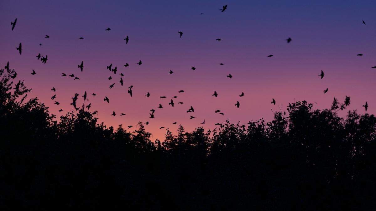
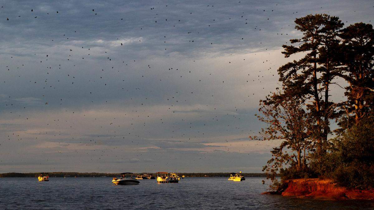
Like clockwork, hordes of these birds flock to Lake Murray each summer. What draws them?
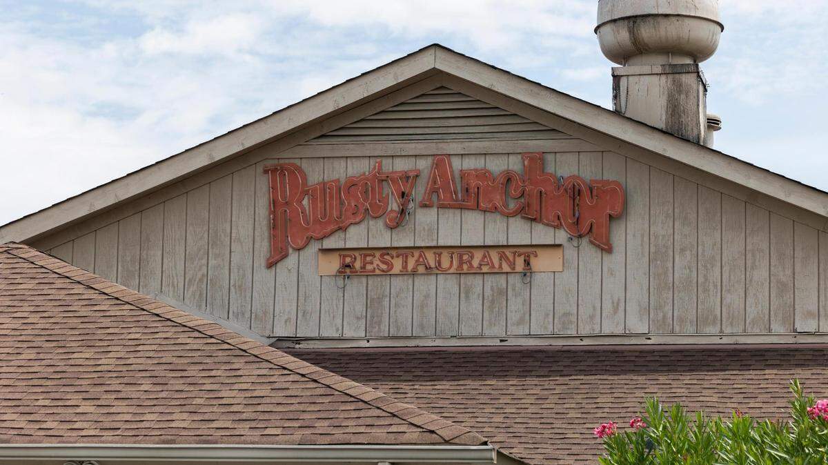
We asked, you voted: Your favorite Lake Murray restaurant is this waterfront gem
Lake Murray is one of the Midlands’ biggest attractions. The 41-mile-long lake attracts boating, fishing and other summertime visitors to points in four different counties that border the lake.
But Lake Murray is more than just a pretty backdrop for your social media posts. An artificial construction dug into the Midlands’ landscape less than 100 years ago, Lake Murray has a history and features that may not immediately be apparent.
Here are five things you didn’t know about Lake Murray.
There was a whole community there before the lake
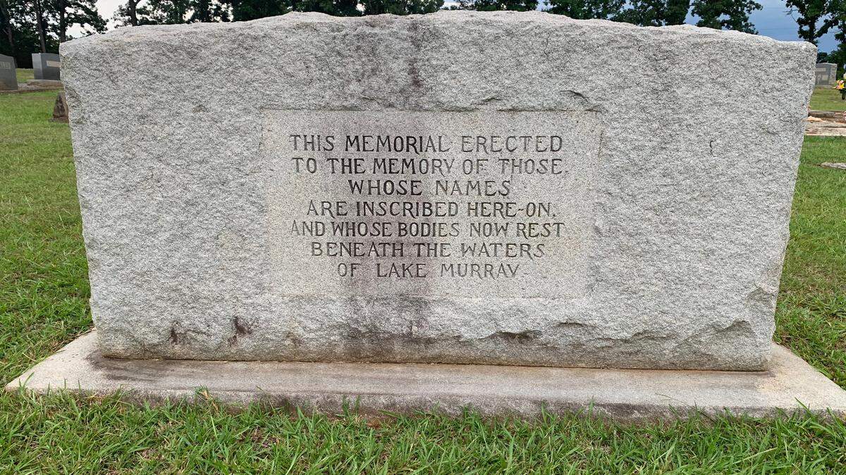
Before the area was flooded to create Lake Murray, several rural but well-developed communities existed on what is now the lake bed. Nearly a dozen identifiable communities were abandoned when the Lexington Water Power Company made plans for a hydro-powered dam in the 1920s — places residents called Derrick, Pine Ridge, Selwood, Wessinger, Cantsville, Leaphart, Savilla, Boyleston, Lorena, Holly’s Ferry and Lorick’s Ferry.

Approximately 100,000 acres of land was purchased for the building of the dam and lake, from more than 5,000 families, at prices between $15 and $45 an acre, according to the official visitors website Lake Murray Country. Six schools, three churches and about 193 graveyards containing 2,323 graves had to be moved. Some families chose not to move the graves, and at several area churches today, there are monuments with the names of the deceased listed.
It took a while to build the lake and its dam
Lake Murray and its dam were constructed between 1927 and 1930 at a cost of $20.1 million, according to Lake Murray Country. It was named after William S. Murray, the engineer who oversaw the design and construction of the dam. Some of the lumber used in building the dam was made from the 100 million feet of board lumber produced from the trees cleared to make way for the lake. The reservoir began to fill with water on Aug. 31, 1929, and the dam produced its first 10,000 kilowatts at 7 a.m., Dec. 1, 1930.
The Lake Murray dam’s real name
While most locals will just refer to the Lake Murray Dam, that’s not the official name of the structure stopping up the Saluda River. If you’re on the north side of North Lake Drive off Bush River Road, you’ll find Dominion Energy’s Lake Murray Dam North Recreational Area. But at the south end you’ll find the Dreher Shoals Dam parking area, using the dam’s official name.
The Dreher Shoals Dam is named after the prominent German Lutheran family that owned riverside property in the Dutch Fork area going back hundreds of years, The State previously reported. Among other things, the Drehers are known for producing the namesake of Dreher High School, former schools superintendent Ernest Dreher.
How big is Lake Murray?
The dam is 1.5 miles long, 375 feet thick, 208 feet high and covers 99 acres. There are four spill gates, each 37.5 feet long by 25 feet wide, according to Lake Murray Country. The dam holds back 763 billion gallons of water.
Between 1943 and 1946, two additional gates were added to the spillway, and the dam was strengthened by raising the crest 3 feet. The spillways were constructed to handle any flood situation where the lake’s level rose above the 360-foot mark.
Lake Murray has a lot of fish
If you enjoy casting a line, Lake Murray is considered one of the nation’s top fishing spots, regularly drawing anglers from far and wide. Fishing options include stripped bass, large-mouth bass, bluegill, crappie, redear sunfish, and catfish. Every spring, the lake is restocked with 1 million stripped bass fingerlings (that’s baby fish to the non-anglers), according to the Lake Murray Visitors Guide.

This story was originally published August 1, 2022 at 4:00 AM.
.jpg)