You can see the SC roads closed because of Debby with this interactive map. Take a look

READ MORE
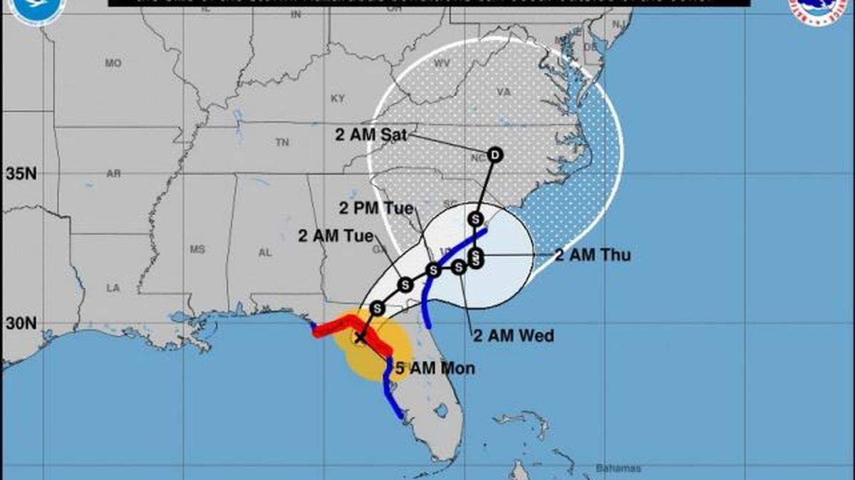
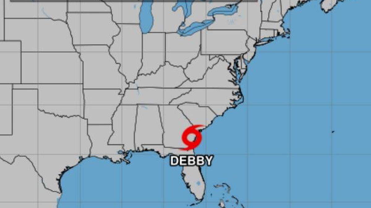
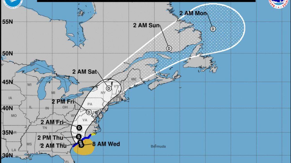
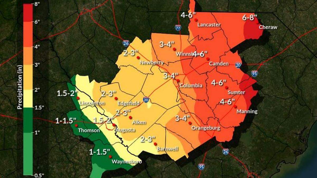
Tropical Storm Debby
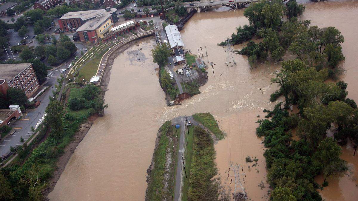
Tropical Storm Debby made landfall in the U.S. on Monday, and will move north toward the Columbia area of South Carolina, where a flood watch has been issued, according to the National Weather Service.
Expand All
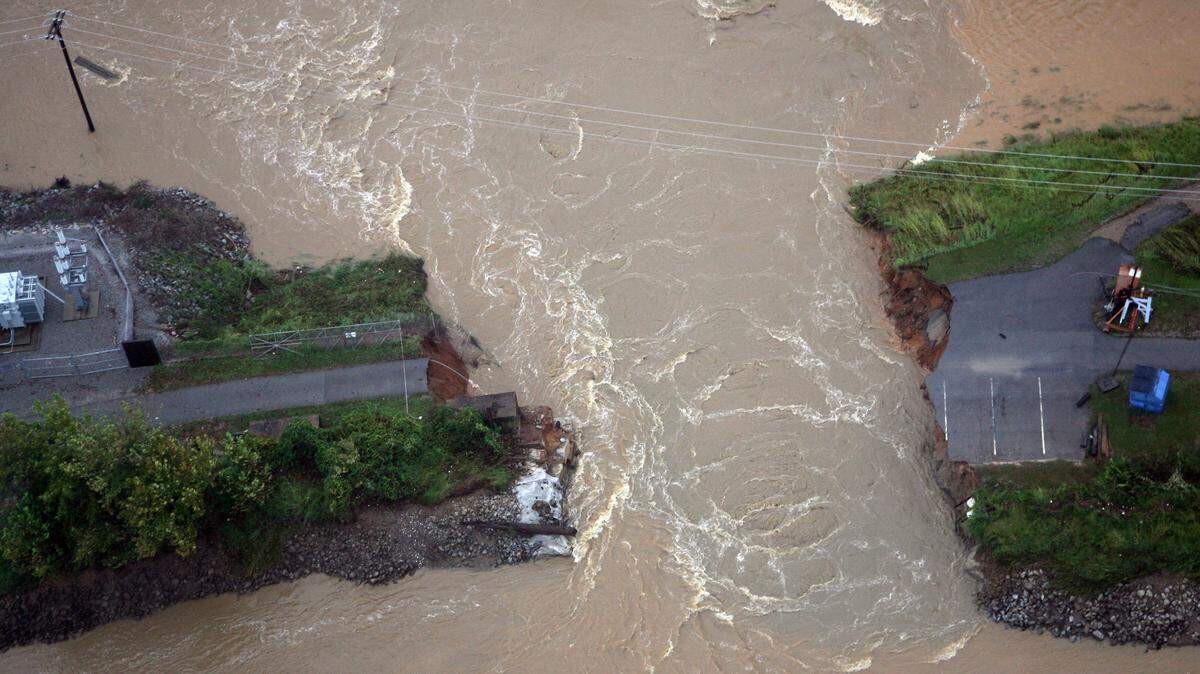
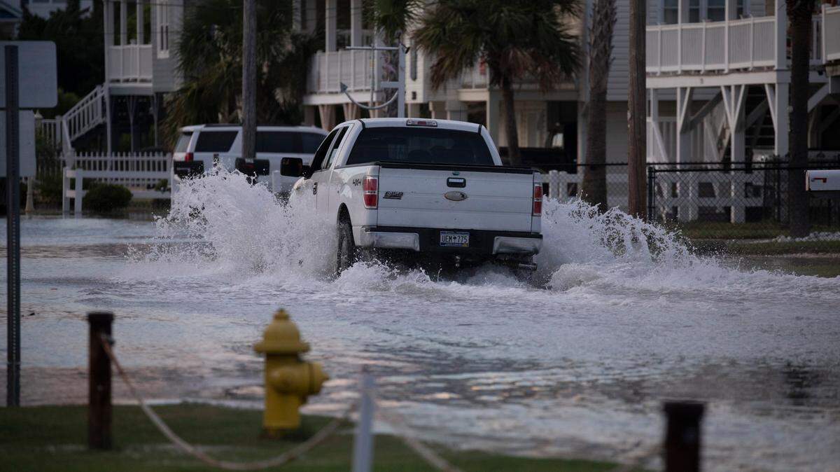
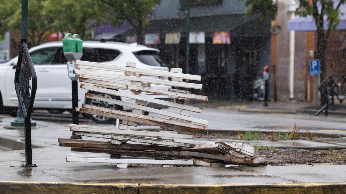
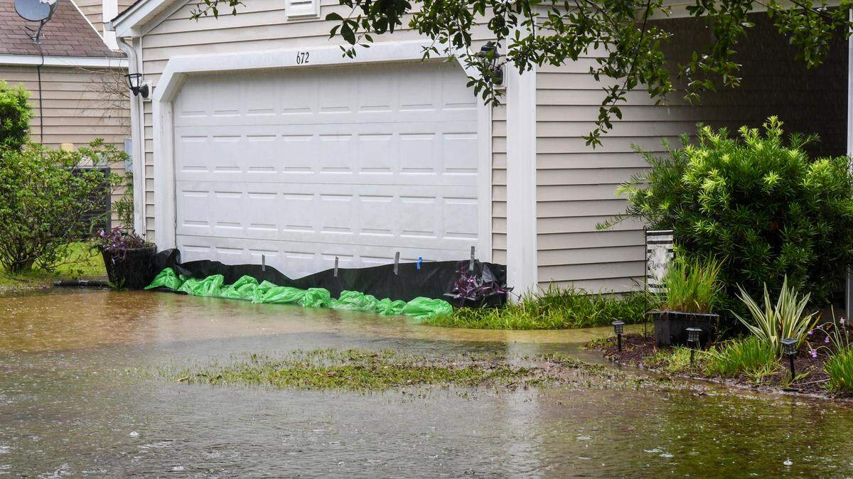
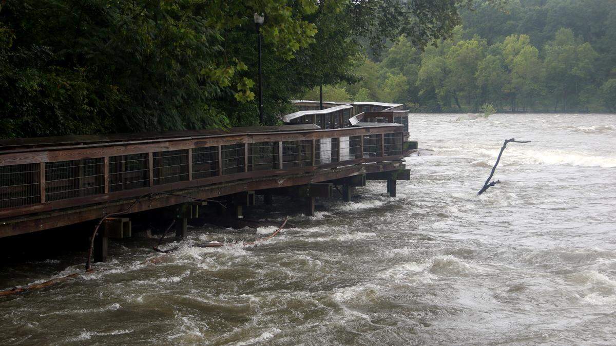
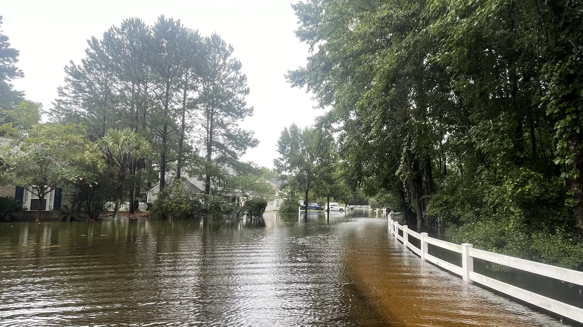
Driving on South Carolina roads has gotten more dangerous as Tropical Storm Debby has slowly moved through the state.
According to the S.C. Department of Transportation, as of midday Tuesday, there were closures on approximately 48 state-maintained roadways, mostly in the Lowcountry.
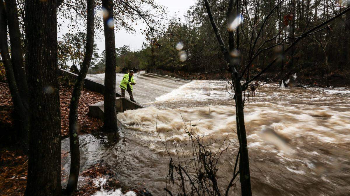
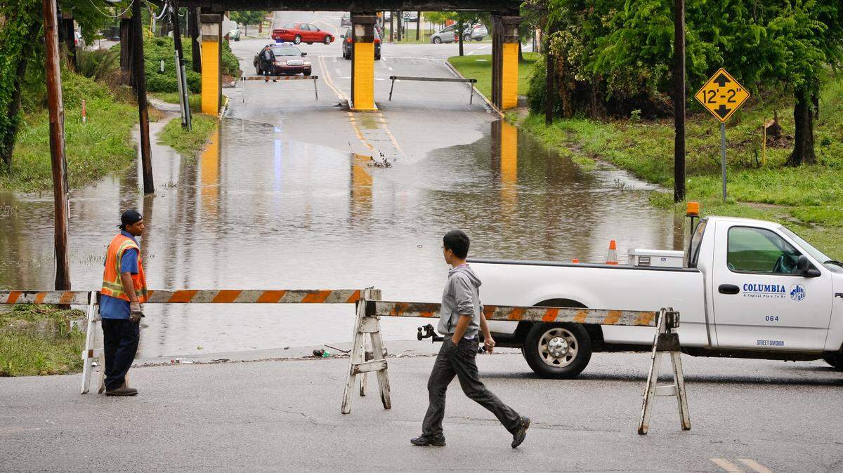
“All major interstates remain open, bur SCDOT is actively monitoring conditions, especially on Interstate 95 where several ramps are closed because of standing water,” SCDOT states.
SCDOT crews are currently working in impacted areas to clear drainage structures, place barricades and remove downed trees and debris from roadways.
Check closed roads
To check on which roads are closed or impacted by Debby click here.
The link will take you to an interactive map of the state. Click on the red spots on the map to get more information about the state-maintained road closures.
More road problems
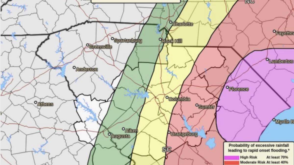
Forecasts show continued heavy rains and possible flash floods in the coming days. As such, SCDOT cautions the public to be aware that road conditions are likely to continue to deteriorate as more water accumulates. South Carolina residents in coastal communities and low-lying areas should be particularly vigilant about checking road conditions before traveling. Real-time road information is available here.
SCDOT encourages the public to call our Customer Service line at 855-467-2368 to report an issue on a state maintained roadway.
This story was originally published August 6, 2024 at 2:55 PM.

.jpeg)


.jpg)
.jpg)